Current Conditions 9:30 AM
Temperature - 20.9°F
Feels Like - 21°F
Dew point - 17°F
Relative humidity - 85%
Wind direction - SE
Wind speed - 4 mph
Barometric pressure - 1000.8 mb falling slightly
Cloud cover - Overcast
Current conditions curtesy of
Weatherunderground from the Third Ward, Eau Claire station
On my walk to class I knew it would be windy but I wasn't expecting it to be in my face the entire time. I walk towards the SE on my way to class and of course that's the direction the wind is out of so the whole time I'm getting snow in my face causing me to continue to wear my face mask.
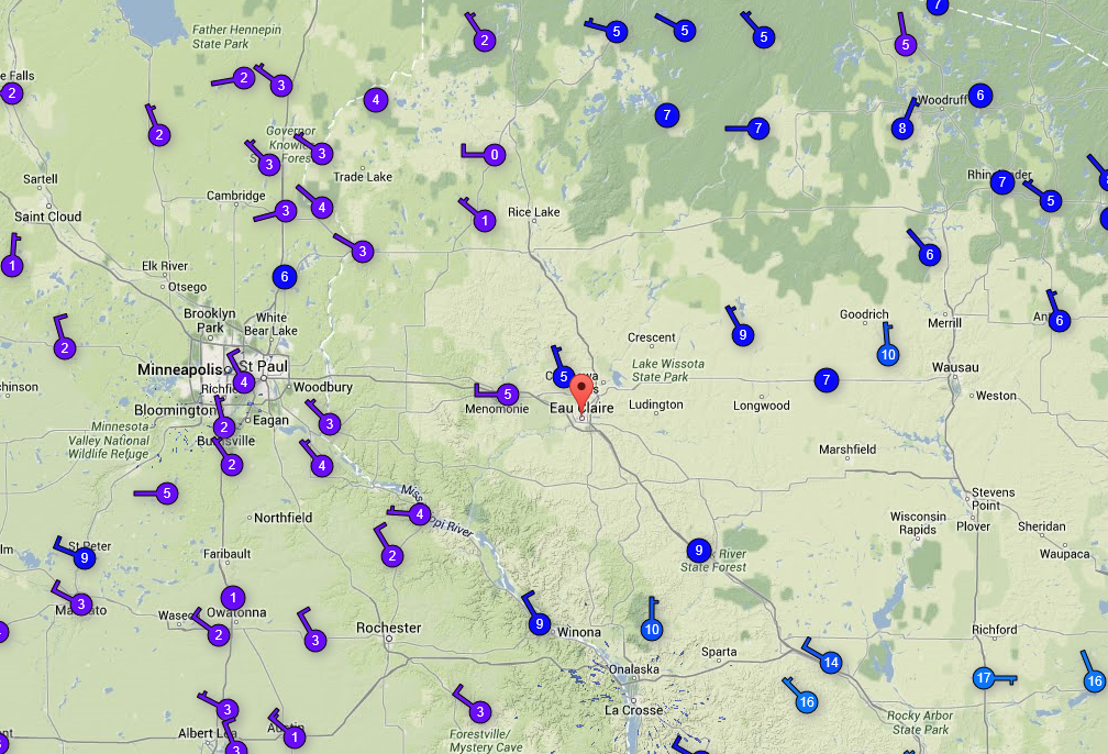
My prediction for today is a little off with the temps and humidity which is partially due to the time of day I'm recording the measurements but also due to the strength of the low pressure system. On the map below you can see where the low pressure is and the following image will show wind direction.
With the low pressure sitting over the Twin Cities we aren't getting the full effect from it but it's still enough to give us a light dusting of snow for the second day in a row. The winds from the SE are bringing with them much needed warmth but as this system moves East we'll be experiencing slightly colder temps but then another warm up and hopefully warm temps for the rest of winter (it's starting to look promising).
My prediction for tomorrow is a very similar to the conditions today with low winds of under 5mph, temps in the low 20s high teens, and a 75% humidity (
+/-5%).